Geolocate

Eenrum topographic map

Click on the map to display elevation.

About this map

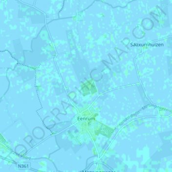
Name: Eenrum topographic map, elevation, terrain.

Location: Eenrum, Het Hogeland, Groningen, Netherlands (53.35151 6.42856 53.39153 6.48049)

Average elevation: 0 ft

Minimum elevation: -10 ft

Maximum elevation: 13 ft

Other topographic maps

Click on a map to view its topography, its elevation and its terrain.

Blokstad

Netherlands > Groningen > Appingedam > Blokstad

Average elevation: -3 ft

Gear up for your next adventure:

🧣Hiking Neck Gaiter - Multi‑use neck protection for outdoor weather
🧭GPS Watch Accessories - Bands and chargers for GPS watches
🛰️Handheld GPS Units - Professional satellite navigators for precise backcountry mapping
🎒Outdoor Daypacks - Lightweight backpacks designed for carrying maps and essential gear
🔥Camping Stove - Portable stove for camping and backcountry cooking

As an Amazon Associate, this site earns from qualifying purchases at no extra cost to you.