Geolocate

Magarao topographic map

Click on the map to display elevation.

About this map

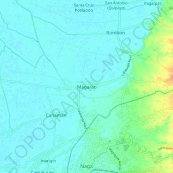
Name: Magarao topographic map, elevation, terrain.

Location: Magarao, Camarines Sur, Bicol Region, 4403, Philippines (13.62071 123.14519 13.70071 123.22519)

Average elevation: 20 ft

Minimum elevation: 0 ft

Maximum elevation: 108 ft

Other topographic maps

Click on a map to view its topography, its elevation and its terrain.

Del Gallego

Philippines > Camarines Sur

Average elevation: 299 ft

Sagñay

Philippines > Camarines Sur

Average elevation: 535 ft

Caramoan

Philippines > Camarines Sur

Average elevation: 138 ft

Gear up for your next adventure:

🚪Portable Camp Chair - Foldable chair for comfort at camp
🪶Wildlife Field Guides - Learn animal tracking and species ID
🚁Photography Drones - Capture stunning aerial views of landforms and topography
🧷Carabiner Set - Durable clips for gear attachment
🔭Compact Binoculars - HD vision for scouting terrain and identifying distant landmarks

As an Amazon Associate, this site earns from qualifying purchases at no extra cost to you.