
Camelback Mountain topographic map
Click on the map to display elevation.
Camelback Mountain
Efforts to protect Camelback Mountain as a natural preserve began in the early 1910s. However, by the 1960s, nearly all of the area had been sold to private interests. Federal and state authorities attempted to stop development above the one thousand and six hundred feet level. They failed to halt development and in 1963 efforts to arrange a land exchange failed in the Arizona State legislature. In 1965, United States Senator Barry Goldwater took up the cause and helped to secure the higher elevations against development. The area became a Phoenix city park in 1968.
About this map
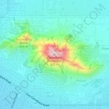
Name: Camelback Mountain topographic map, elevation, terrain.
Average elevation: 1,519 ft
Minimum elevation: 1,276 ft
Maximum elevation: 2,618 ft
Maricopa County trails, hiking, mountain biking, running and outdoor activities
Other topographic maps
Click on a map to view its topography, its elevation and its terrain.