Geolocate

Siecha topographic map

Click on the map to display elevation.

About this map

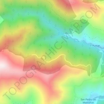
Name: Siecha topographic map, elevation, terrain.

Location: Siecha, Cangas del Narcea, Asturias, Spain (43.15963 -6.68786 43.17963 -6.66786)

Average elevation: 2,927 ft

Minimum elevation: 1,900 ft

Maximum elevation: 4,127 ft

Gear up for your next adventure:

🔭Compact Binoculars - HD vision for scouting terrain and identifying distant landmarks
🔋Rechargeable Batteries - Power up your outdoor devices
🧥Waterproof Jacket for Hiking - Breathable and rugged rain jacket for outdoor excursions
😴Insulated Sleeping Pads - Compact and warm pads for high-elevation camping
🧣Hiking Neck Gaiter - Multi‑use neck protection for outdoor weather

As an Amazon Associate, this site earns from qualifying purchases at no extra cost to you.