
Thank you for supporting this site ❤️
Make a donation
Make a donation
Gear up for your next adventure:
As an Amazon Associate, this site earns from qualifying purchases at no extra cost to you.
Sarvelat topographic map
Click on the map to display elevation.
Thank you for supporting this site ❤️
Make a donation
Make a donation
Gear up for your next adventure:
As an Amazon Associate, this site earns from qualifying purchases at no extra cost to you.
About this map
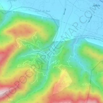
Name: Sarvelat topographic map, elevation, terrain.
Location: Sarvelat, بخش چابکسر, Rudsar County, Gilan Province, Iran (36.93625 50.52894 36.97625 50.56894)
Average elevation: 686 ft
Minimum elevation: -56 ft
Maximum elevation: 2,129 ft
Thank you for supporting this site ❤️
Make a donation
Make a donation
Gear up for your next adventure:
As an Amazon Associate, this site earns from qualifying purchases at no extra cost to you.