
Thank you for supporting this site ❤️
Make a donation
Make a donation
Gear up for your next adventure:
As an Amazon Associate, this site earns from qualifying purchases at no extra cost to you.
Dam-an topographic map
Click on the map to display elevation.
Thank you for supporting this site ❤️
Make a donation
Make a donation
Gear up for your next adventure:
As an Amazon Associate, this site earns from qualifying purchases at no extra cost to you.
About this map
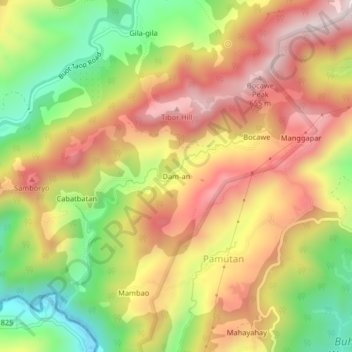
Name: Dam-an topographic map, elevation, terrain.
Location: Dam-an, Pamutan, Cebu City, Central Visayas, Philippines (10.32283 123.81003 10.36283 123.85003)
Average elevation: 1,302 ft
Minimum elevation: 226 ft
Maximum elevation: 2,251 ft
Thank you for supporting this site ❤️
Make a donation
Make a donation
Gear up for your next adventure:
As an Amazon Associate, this site earns from qualifying purchases at no extra cost to you.