
Olekminsk topographic map
Interactive map
Click on the map to display elevation.
About this map
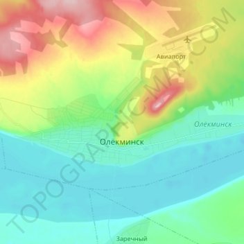
Name: Olekminsk topographic map, elevation, terrain.
Average elevation: 587 ft
Minimum elevation: 387 ft
Maximum elevation: 1,043 ft
Other topographic maps
Click on a map to view its topography, its elevation and its terrain.
Olyokminsk
Russia > Sakha Republic > Olyokminsky Ulus > Olyokminsk
Olyokminsk, городское поселение Олёкминск, Olyokminsky Ulus, Sakha Republic, Far Eastern Federal District, 678100, Russia
Average elevation: 581 ft
Sanyyakhtakh
Russia > Sakha Republic > Olyokminsky Ulus > Sanyyakhtakh
Sanyyakhtakh, Саныяхтахский наслег, Olyokminsky Ulus, Sakha Republic, Far Eastern Federal District, Russia
Average elevation: 430 ft