
Bucovăț topographic map
Interactive map
Click on the map to display elevation.
About this map
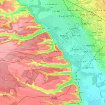
Name: Bucovăț topographic map, elevation, terrain.
Location: Bucovăț, Craiova Metropolitan Area, Dolj, Romania (44.23551 23.58498 44.32828 23.77205)
Average elevation: 400 ft
Minimum elevation: 210 ft
Maximum elevation: 604 ft
Other topographic maps
Click on a map to view its topography, its elevation and its terrain.