
Craiova topographic map
Interactive map
Click on the map to display elevation.
About this map
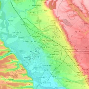
Name: Craiova topographic map, elevation, terrain.
Location: Craiova, Craiova Metropolitan Area, Dolj, Romania (44.26808 23.70792 44.37865 23.90582)
Average elevation: 417 ft
Minimum elevation: 217 ft
Maximum elevation: 709 ft
Other topographic maps
Click on a map to view its topography, its elevation and its terrain.