
Make a donation
Gear up for your next adventure:
As an Amazon Associate, this site earns from qualifying purchases at no extra cost to you.
San Tomas topographic map
Click on the map to display elevation.
Make a donation
Gear up for your next adventure:
As an Amazon Associate, this site earns from qualifying purchases at no extra cost to you.
About this map
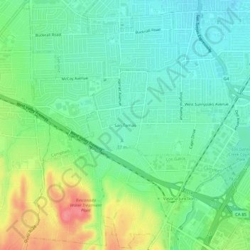
Name: San Tomas topographic map, elevation, terrain.
Average elevation: 269 ft
Minimum elevation: 180 ft
Maximum elevation: 446 ft
Santa Clara County trails, hiking, mountain biking, running and outdoor activities
Make a donation
Gear up for your next adventure:
As an Amazon Associate, this site earns from qualifying purchases at no extra cost to you.
Other topographic maps
Click on a map to view its topography, its elevation and its terrain.
Camden Pond No. 3
United States > California > Santa Clara County > Campbell
Average elevation: 236 ft
Los Gatos Creek County Park
United States > California > Santa Clara County > Campbell
Average elevation: 246 ft