
Thank you for supporting this site ❤️
Make a donation
Make a donation
Gear up for your next adventure:
As an Amazon Associate, this site earns from qualifying purchases at no extra cost to you.
Murgash topographic map
Click on the map to display elevation.
Thank you for supporting this site ❤️
Make a donation
Make a donation
Gear up for your next adventure:
As an Amazon Associate, this site earns from qualifying purchases at no extra cost to you.
About this map
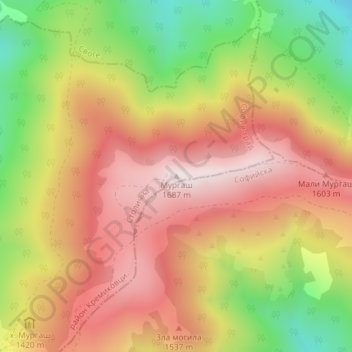
Name: Murgash topographic map, elevation, terrain.
Location: Murgash, Kremikovci, Sofia City, Sofia-City, Bulgaria (42.83298 23.66845 42.83308 23.66855)
Average elevation: 4,619 ft
Minimum elevation: 3,465 ft
Maximum elevation: 5,518 ft
Thank you for supporting this site ❤️
Make a donation
Make a donation
Gear up for your next adventure:
As an Amazon Associate, this site earns from qualifying purchases at no extra cost to you.