
吕店镇 topographic map
Interactive map
Click on the map to display elevation.
About this map
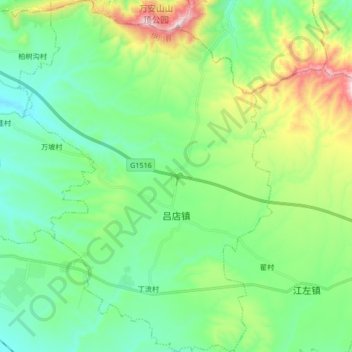
Name: 吕店镇 topographic map, elevation, terrain.
Location: 吕店镇, 伊川县, 洛阳市, 河南省, 中国 (34.38336 112.54606 34.52216 112.66850)
Average elevation: 1,381 ft
Minimum elevation: 784 ft
Maximum elevation: 3,005 ft
Other topographic maps
Click on a map to view its topography, its elevation and its terrain.