Geolocate

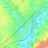
Greenstead Green topographic map

Click on the map to display elevation.

About this map

Name: Greenstead Green topographic map, elevation, terrain.

Location: Greenstead Green, Braintree, Essex, England, CO9 1QX, United Kingdom (51.90057 0.63094 51.94057 0.67094)

Average elevation: 200 ft

Minimum elevation: 95 ft

Maximum elevation: 279 ft

Other topographic maps

Click on a map to view its topography, its elevation and its terrain.

Witham

United Kingdom > England > Essex > Braintree > Rivenhall End

Average elevation: 95 ft

Kelvedon

United Kingdom > England > Essex > Braintree > Kelvedon

Average elevation: 128 ft

Sible Hedingham

United Kingdom > England > Essex > Braintree

Average elevation: 233 ft

Halstead

United Kingdom > England > Essex > Braintree > Halstead

Average elevation: 197 ft

Witham

United Kingdom > England > Essex > Braintree > Rivenhall End

Average elevation: 118 ft

Coggeshall

United Kingdom > England > Essex > Braintree > Coggeshall

Average elevation: 180 ft

Rivenhall

United Kingdom > England > Essex > Braintree > Rivenhall

Average elevation: 112 ft

Sturmer

United Kingdom > England > Essex > Braintree > Sturmer

Average elevation: 240 ft

Rayne

United Kingdom > England > Essex > Braintree > Rayne

Average elevation: 243 ft

Gear up for your next adventure:

🎒Trekking Poles - Sturdy poles for balance and stability on rough terrain
🎒Outdoor Daypacks - Lightweight backpacks designed for carrying maps and essential gear
🧣Hiking Neck Gaiter - Multi‑use neck protection for outdoor weather
🛌Ultralight Sleeping Bags - Compact down bags for cold nights in the wilderness
⌚GPS Sports Watch - GPS watch for running, hiking and training

As an Amazon Associate, this site earns from qualifying purchases at no extra cost to you.