Geolocate

Kyagar topographic map

Click on the map to display elevation.

Kyagar

Tegar, also known as Kyagar, is a high-altitude village in the Leh district of Ladakh, India. It is located in the Nubra tehsil, in the Nubra Valley.

Wikipedia (CC-BY-SA 3.0)

About this map

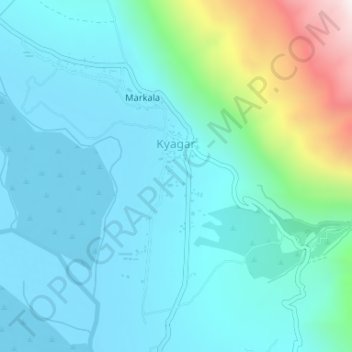
Name: Kyagar topographic map, elevation, terrain.

Location: Kyagar, Nubra, Leh district, Ladakh, India (34.63190 77.61230 34.64113 77.61692)

Average elevation: 10,712 ft

Minimum elevation: 10,184 ft

Maximum elevation: 13,068 ft

Gear up for your next adventure:

🦶Carbon Trekking Poles - Reduce knee impact on steep descents with ultra-light poles
🛰️Satellite Messengers - Emergency SOS and two-way messaging for off-grid adventures
📱Solar Portable Charger - Solar power bank for charging devices off‑grid
🧦Hiking Socks - Comfortable socks to prevent blisters on long hikes
🧭Pro Hiking Compasses - High-accuracy liquid-filled compasses for topographic orientation

As an Amazon Associate, this site earns from qualifying purchases at no extra cost to you.