Geolocate

Saint Simons topographic map

Click on the map to display elevation.

About this map

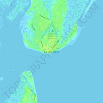
Name: Saint Simons topographic map, elevation, terrain.

Location: Saint Simons, Glynn County, Georgia, 31522, United States (31.09538 -81.42952 31.17538 -81.34952)

Average elevation: 7 ft

Minimum elevation: -10 ft

Maximum elevation: 46 ft

Glynn County trails, hiking, mountain biking, running and outdoor activities

Other topographic maps

Click on a map to view its topography, its elevation and its terrain.

Gear up for your next adventure:

🔥Fast-Boil Camping Stoves - Efficient cooking systems for quick trail meals
🧯Portable Fire Pit - Compact fire pit for camping spots
🪑Ultralight Camp Chairs - Portable seating for resting after a long day of mapping
🥘Titanium Cookware - Durable, featherlight pots and pans for backpacking
🪶Wildlife Field Guides - Learn animal tracking and species ID

As an Amazon Associate, this site earns from qualifying purchases at no extra cost to you.