Geolocate

Crofton topographic map

Click on the map to display elevation.

About this map

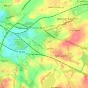
Name: Crofton topographic map, elevation, terrain.

Location: Crofton, Wakefield, West Yorkshire, England, United Kingdom (53.64510 -1.47576 53.66961 -1.40538)

Average elevation: 177 ft

Minimum elevation: 79 ft

Maximum elevation: 279 ft

Gear up for your next adventure:

🧷Carabiner Set - Durable clips for gear attachment
🔦Compact Flashlight - Reliable flashlight for emergencies
💧Water Purification System - Clean water on the trail with reliable purifiers
🪓Survival Multi‑Tool - Versatile tool for camp and trail tasks
🧭Pro Hiking Compasses - High-accuracy liquid-filled compasses for topographic orientation

As an Amazon Associate, this site earns from qualifying purchases at no extra cost to you.