
Thank you for supporting this site ❤️
Make a donation
Make a donation
Gear up for your next adventure:
As an Amazon Associate, this site earns from qualifying purchases at no extra cost to you.
Tagdemt topographic map
Click on the map to display elevation.
Thank you for supporting this site ❤️
Make a donation
Make a donation
Gear up for your next adventure:
As an Amazon Associate, this site earns from qualifying purchases at no extra cost to you.
About this map
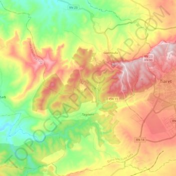
Name: Tagdemt topographic map, elevation, terrain.
Location: Tagdemt, Mechraa Safa District, Tiaret, Algeria (35.27623 1.09918 35.44312 1.29452)
Average elevation: 2,900 ft
Minimum elevation: 1,975 ft
Maximum elevation: 3,993 ft
Thank you for supporting this site ❤️
Make a donation
Make a donation
Gear up for your next adventure:
As an Amazon Associate, this site earns from qualifying purchases at no extra cost to you.