Geolocate

Canton topographic map

Click on the map to display elevation.

About this map

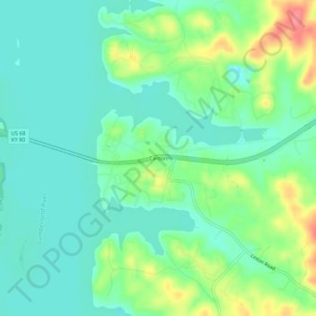
Name: Canton topographic map, elevation, terrain.

Location: Canton, Trigg County, Kentucky, United States (36.77894 -87.98086 36.81894 -87.94086)

Average elevation: 400 ft

Minimum elevation: 325 ft

Maximum elevation: 571 ft

Trigg County trails, hiking, mountain biking, running and outdoor activities

Gear up for your next adventure:

📦Gear Storage Bags - Organize and protect outdoor equipment
🛏️Cold Weather Sleeping Bag - Warm sleeping bag for cold conditions
🔥Plasma Lighters - Windproof lighters that work in any weather condition
👖Convertible Hiking Pants - Versatile zip-off pants for changing altitudes and temperatures
🛠️Outdoor Gear Repair Kit - Essential tools to fix gear on the trail

As an Amazon Associate, this site earns from qualifying purchases at no extra cost to you.