
Karu topographic map
Click on the map to display elevation.
About this map
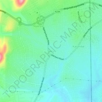
Name: Karu topographic map, elevation, terrain.
Location: Karu, Municipal Area Council, Federal Capital Territory, Nigeria (8.99135 7.55505 9.03135 7.59505)
Average elevation: 1,385 ft
Minimum elevation: 1,247 ft
Maximum elevation: 1,847 ft
Other topographic maps
Click on a map to view its topography, its elevation and its terrain.
Maitama
Nigeria > Federal Capital Territory > Municipal Area Council > Abuja
Average elevation: 1,680 ft