
De Doorns topographic map
Click on the map to display elevation.
About this map
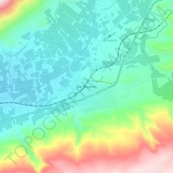
Name: De Doorns topographic map, elevation, terrain.
Average elevation: 2,241 ft
Minimum elevation: 1,342 ft
Maximum elevation: 4,780 ft
Other topographic maps
Click on a map to view its topography, its elevation and its terrain.
Hex River
South Africa > Western Cape > Cape Winelands District Municipality > Breede Valley Local Municipality
Average elevation: 2,113 ft
Breede River
South Africa > Western Cape > Cape Winelands District Municipality > Breede Valley Local Municipality
Average elevation: 719 ft