
Make a donation
Gear up for your next adventure:
As an Amazon Associate, this site earns from qualifying purchases at no extra cost to you.
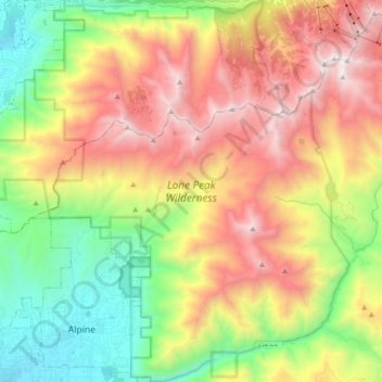
Lone Peak Wilderness topographic map
Click on the map to display elevation.
Make a donation
Gear up for your next adventure:
As an Amazon Associate, this site earns from qualifying purchases at no extra cost to you.
Lone Peak Wilderness
The Lone Peak Wilderness provides a spectacular backdrop for the growing urban areas along the Wasatch Front and is dominated by rugged terrain, narrow canyons and high peaks, including the Pfeifferhorn, commonly referred to as Little Matterhorn Peak, at 11,326 feet (3,452 m) and Lone Peak at 11,253 feet (3,430 meters). The geologic structure of the area is varied and complex, consisting of granitoid rock masses and several sedimentary formations. Carving of the present alpine topography is due to glaciation, with erosion being the current dominant force in the land sculpturing process. Much of the higher elevation is alpine, characterized by large, open cirque basins and exposed rocky ridges. A few small natural and reservoired lakes add to the scenic beauty.
Make a donation
Gear up for your next adventure:
As an Amazon Associate, this site earns from qualifying purchases at no extra cost to you.
About this map
Name: Lone Peak Wilderness topographic map, elevation, terrain.
Average elevation: 7,766 ft
Minimum elevation: 4,803 ft
Maximum elevation: 11,417 ft
Utah County trails, hiking, mountain biking, running and outdoor activities
Make a donation
Gear up for your next adventure:
As an Amazon Associate, this site earns from qualifying purchases at no extra cost to you.