Geolocate

Two Rivers Park topographic map

Click on the map to display elevation.

About this map

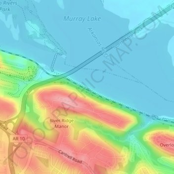
Name: Two Rivers Park topographic map, elevation, terrain.

Location: Two Rivers Park, Overlook Park, Little Rock, Pulaski County, Arkansas, United States (34.79076 -92.38833 34.80002 -92.36448)

Average elevation: 364 ft

Minimum elevation: 240 ft

Maximum elevation: 640 ft

Pulaski County trails, hiking, mountain biking, running and outdoor activities

Other topographic maps

Click on a map to view its topography, its elevation and its terrain.

Gear up for your next adventure:

👟Men's Trail Runners - Lightweight footwear for fast-paced exploration and light hiking
🧯Emergency Survival Kit - All‑in‑one survival essentials for the backcountry
📖Nature Tracking Books - Learn to track wildlife and terrain
📷Action Camera - Capture your outdoor adventures in HD
🌐World Map Poster - Decorative world maps with topographic info

As an Amazon Associate, this site earns from qualifying purchases at no extra cost to you.