
Thank you for supporting this site ❤️
Make a donation
Make a donation
Gear up for your next adventure:
As an Amazon Associate, this site earns from qualifying purchases at no extra cost to you.
Bellerive topographic map
Click on the map to display elevation.
Thank you for supporting this site ❤️
Make a donation
Make a donation
Gear up for your next adventure:
As an Amazon Associate, this site earns from qualifying purchases at no extra cost to you.
About this map
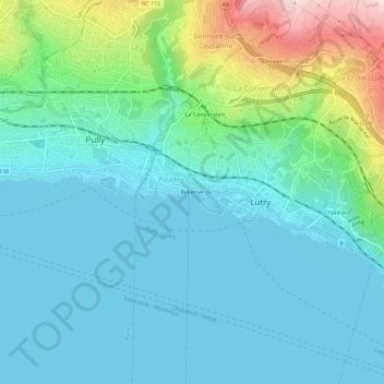
Name: Bellerive topographic map, elevation, terrain.
Location: Bellerive, Lutry, District de Lavaux-Oron, Vaud, 1094, Suisse (46.48430 6.65642 46.52430 6.69642)
Average elevation: 1,470 ft
Minimum elevation: 1,211 ft
Maximum elevation: 2,470 ft
Thank you for supporting this site ❤️
Make a donation
Make a donation
Gear up for your next adventure:
As an Amazon Associate, this site earns from qualifying purchases at no extra cost to you.