
Santa Rosa topographic map
Click on the map to display elevation.
About this map
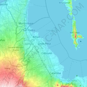
Name: Santa Rosa topographic map, elevation, terrain.
Location: Santa Rosa, Laguna, Calabarzon, 4026, Philippines (14.15435 120.95213 14.47435 121.27213)
Average elevation: 213 ft
Minimum elevation: -13 ft
Maximum elevation: 1,640 ft
Other topographic maps
Click on a map to view its topography, its elevation and its terrain.