Geolocate

Ayas topographic map

Click on the map to display elevation.

About this map

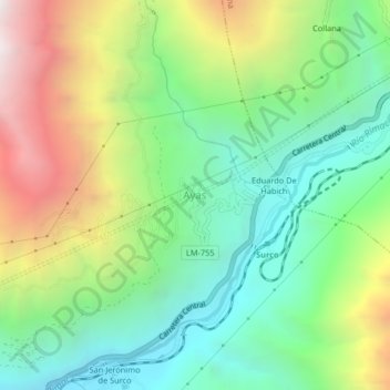
Name: Ayas topographic map, elevation, terrain.

Location: Ayas, Surco, Province of Huarochirí, Lima, Peru (-11.88544 -76.45187 -11.84544 -76.41187)

Average elevation: 8,747 ft

Minimum elevation: 6,476 ft

Maximum elevation: 12,717 ft

Gear up for your next adventure:

🧭Map Reading Tools - Tools and kits for map navigation
🔥Camping Stove - Portable stove for camping and backcountry cooking
🧯Emergency Survival Kit - All‑in‑one survival essentials for the backcountry
📡Handheld GPS Device - Reliable handheld GPS for outdoor navigation
🧭Compass with Lanyard - Easy‑carry compass for navigation

As an Amazon Associate, this site earns from qualifying purchases at no extra cost to you.