Geolocate

Carol Stream topographic map

Click on the map to display elevation.

About this map

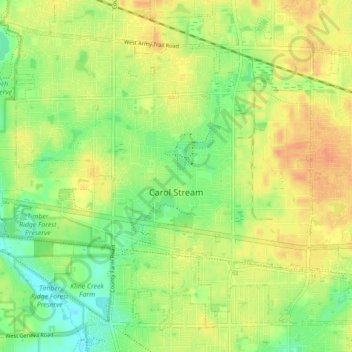
Name: Carol Stream topographic map, elevation, terrain.

Location: Carol Stream, DuPage County, Illinois, United States (41.88803 -88.17486 41.94281 -88.08717)

Average elevation: 774 ft

Minimum elevation: 712 ft

Maximum elevation: 823 ft

Other topographic maps

Click on a map to view its topography, its elevation and its terrain.

Elmhurst

United States > Illinois > DuPage County

Due to local topography, the town has had a tendency to flood in the past after large rainfalls; the city is currently undertaking a large effort to mitigate future flooding.

Average elevation: 679 ft

Morton Arboretum

United States > Illinois > DuPage County > Lisle

Average elevation: 722 ft

Elmhurst

United States > Illinois > DuPage County

Due to local topography, the town has had a tendency to flood in the past after large rainfalls; the city is currently undertaking a large effort to mitigate future flooding.

Average elevation: 679 ft

Wheaton

United States > Illinois > DuPage County

Average elevation: 761 ft

Elmhurst

United States > Illinois > DuPage County

Due to local topography, the town has had a tendency to flood in the past after large rainfalls; the city is currently undertaking a large effort to mitigate future flooding.

Average elevation: 679 ft

Medinah

United States > Illinois > DuPage County

Average elevation: 738 ft

Gear up for your next adventure:

🔦Powerful Headlamps - Ultra-bright hands-free lighting for night navigation
🧤Hiking Gloves - Protective gloves for rugged trails
🛶Inflatable Kayak - Portable kayak for rivers, lakes, and expeditions
🎒Hydration Pack - Hands‑free water reservoir for long hikes
🪶Camp Gear Gift Set - Perfect gift bundle for outdoor fans

As an Amazon Associate, this site earns from qualifying purchases at no extra cost to you.