
Thank you for supporting this site ❤️
Make a donation
Make a donation
Gear up for your next adventure:
As an Amazon Associate, this site earns from qualifying purchases at no extra cost to you.
惠民乡 topographic map
Click on the map to display elevation.
Thank you for supporting this site ❤️
Make a donation
Make a donation
Gear up for your next adventure:
As an Amazon Associate, this site earns from qualifying purchases at no extra cost to you.
About this map
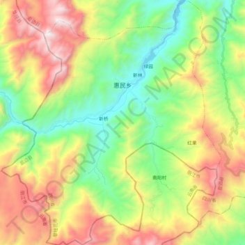
Name: 惠民乡 topographic map, elevation, terrain.
Location: 惠民乡, 盐边县, Panzhihua, Sichuan, China (26.72438 101.35409 26.88473 101.51545)
Average elevation: 6,060 ft
Minimum elevation: 3,862 ft
Maximum elevation: 9,400 ft
Thank you for supporting this site ❤️
Make a donation
Make a donation
Gear up for your next adventure:
As an Amazon Associate, this site earns from qualifying purchases at no extra cost to you.