
Himbleton topographic map
Click on the map to display elevation.
About this map
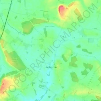
Name: Himbleton topographic map, elevation, terrain.
Location: Himbleton, Wychavon, Worcestershire, England, United Kingdom (52.21342 -2.12663 52.24993 -2.04733)
Average elevation: 171 ft
Minimum elevation: 102 ft
Maximum elevation: 331 ft
Other topographic maps
Click on a map to view its topography, its elevation and its terrain.
Earls Common
United Kingdom > England > Worcestershire > Wychavon > Himbleton
Average elevation: 167 ft
Stock Green
United Kingdom > England > Worcestershire > Wychavon > Inkberrow
Average elevation: 180 ft
Atch Lench
United Kingdom > England > Worcestershire > Wychavon > Church Lench
Average elevation: 262 ft
Badsey Lane Nature Reserve
United Kingdom > England > Worcestershire > Wychavon > Evesham
Average elevation: 121 ft