Geolocate

Deru topographic map

Click on the map to display elevation.

About this map

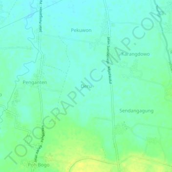
Name: Deru topographic map, elevation, terrain.

Location: Deru, Bojonegoro, East Java, Java, 62182, Indonesia (-7.23079 111.97620 -7.19079 112.01620)

Average elevation: 82 ft

Minimum elevation: 59 ft

Maximum elevation: 118 ft

Other topographic maps

Click on a map to view its topography, its elevation and its terrain.

Gondang

Indonesia > East Java > Bojonegoro

Average elevation: 748 ft

Sekar

Indonesia > East Java > Bojonegoro

Average elevation: 653 ft

Gear up for your next adventure:

📱Solar Portable Charger - Solar power bank for charging devices off‑grid
🧥Men's Rain Shells - Premium waterproof and breathable jackets for mountain weather
🥾Hiking Shoes - Durable and comfortable shoes for trail hiking
🎒Waterproof Dry Bags - Keep your electronics and maps dry inside your pack
🪶LED Camping Lantern - Bright lantern for camp lighting

As an Amazon Associate, this site earns from qualifying purchases at no extra cost to you.