Geolocate

Tsarimir topographic map

Click on the map to display elevation.

About this map

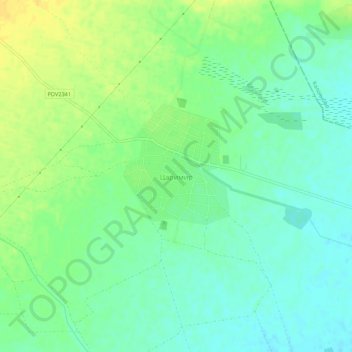
Name: Tsarimir topographic map, elevation, terrain.

Location: Tsarimir, Saedinenie, Plovdiv, Bulgaria (42.30270 24.65244 42.34270 24.69244)

Average elevation: 709 ft

Minimum elevation: 673 ft

Maximum elevation: 755 ft

Other topographic maps

Click on a map to view its topography, its elevation and its terrain.

Западен

Bulgaria > Plovdiv > Plovdiv

Average elevation: 564 ft

Hisaria

Bulgaria > Plovdiv

Average elevation: 1,719 ft

Южен

Bulgaria > Plovdiv

Average elevation: 568 ft

Източен

Bulgaria > Plovdiv

Average elevation: 522 ft

Южен

Bulgaria > Plovdiv

Average elevation: 568 ft

Централен

Bulgaria > Plovdiv

Average elevation: 551 ft

Gear up for your next adventure:

🧭GPS Watch Accessories - Bands and chargers for GPS watches
👟Men's Trail Runners - Lightweight footwear for fast-paced exploration and light hiking
🛏️Cold Weather Sleeping Bag - Warm sleeping bag for cold conditions
📱Solar Portable Charger - Solar power bank for charging devices off‑grid
🪑Ultralight Camp Chairs - Portable seating for resting after a long day of mapping

As an Amazon Associate, this site earns from qualifying purchases at no extra cost to you.