
Sodom topographic map
Click on the map to display elevation.
About this map
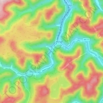
Name: Sodom topographic map, elevation, terrain.
Location: Sodom, Logan County, West Virginia, 25183, United States (37.89649 -81.85318 37.93649 -81.81318)
Average elevation: 1,283 ft
Minimum elevation: 827 ft
Maximum elevation: 1,788 ft
Logan County trails, hiking, mountain biking, running and outdoor activities