Geolocate

Poriem topographic map

Click on the map to display elevation.

About this map

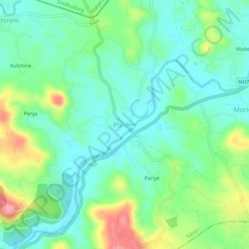
Name: Poriem topographic map, elevation, terrain.

Location: Poriem, Satari, North Goa, Goa, 403505, India (15.56919 74.00693 15.60919 74.04693)

Average elevation: 141 ft

Minimum elevation: 26 ft

Maximum elevation: 410 ft

Gear up for your next adventure:

🎒Trekking Poles - Sturdy poles for balance and stability on rough terrain
🗺️NatGeo Topo Maps - High-quality waterproof printed topographic maps of US Parks
🔥Plasma Lighters - Windproof lighters that work in any weather condition
🎁Geography Themed Gifts - Unique gift ideas for map lovers and geography enthusiasts
🔭Telescopic Hiking Pole - Adjustable pole for hiking stability

As an Amazon Associate, this site earns from qualifying purchases at no extra cost to you.