
Make a donation
Gear up for your next adventure:
As an Amazon Associate, this site earns from qualifying purchases at no extra cost to you.
Tafresh topographic map
Click on the map to display elevation.
Make a donation
Gear up for your next adventure:
As an Amazon Associate, this site earns from qualifying purchases at no extra cost to you.
Tafresh
The flight distance between Tehran and Tafresh is 170 km towards southwest. The average altitude of Tafresh is 1912 meters above sea level, with a continental and semi-arid climate with an annual rainfall of 270 mm.
Make a donation
Gear up for your next adventure:
As an Amazon Associate, this site earns from qualifying purchases at no extra cost to you.
About this map
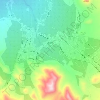
Name: Tafresh topographic map, elevation, terrain.
Average elevation: 6,417 ft
Minimum elevation: 5,984 ft
Maximum elevation: 7,326 ft
Make a donation
Gear up for your next adventure:
As an Amazon Associate, this site earns from qualifying purchases at no extra cost to you.
Other topographic maps
Click on a map to view its topography, its elevation and its terrain.