Geolocate

Buntu Mondong topographic map

Click on the map to display elevation.

About this map

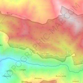
Name: Buntu Mondong topographic map, elevation, terrain.

Location: Buntu Mondong, Enrekang, South Sulawesi, Sulawesi, Indonesia (-3.44640 119.90860 -3.40640 119.94860)

Average elevation: 4,262 ft

Minimum elevation: 2,129 ft

Maximum elevation: 5,886 ft

Other topographic maps

Click on a map to view its topography, its elevation and its terrain.

Malua

Indonesia > South Sulawesi > Enrekang

Average elevation: 2,326 ft

Alla

Indonesia > South Sulawesi > Enrekang

Average elevation: 3,402 ft

Baraka

Indonesia > South Sulawesi > Enrekang

Average elevation: 2,713 ft

Buntu Batu

Indonesia > South Sulawesi > Enrekang

Average elevation: 4,787 ft

Bungin

Indonesia > South Sulawesi > Enrekang

Average elevation: 4,062 ft

Cendana

Indonesia > South Sulawesi > Enrekang

Average elevation: 499 ft

Maiwa

Indonesia > South Sulawesi > Enrekang

Average elevation: 702 ft

Malua

Indonesia > South Sulawesi > Enrekang

Average elevation: 2,326 ft

Gear up for your next adventure:

🧭Map Reading Tools - Tools and kits for map navigation
🛌Ultralight Sleeping Bags - Compact down bags for cold nights in the wilderness
🧭Compass with Lanyard - Easy‑carry compass for navigation
🌄Hiking Binoculars - Compact binoculars for scenic views and trail spotting
🌡️Handheld Weather Meters - Measure wind, temp, and pressure for safe mountain travel

As an Amazon Associate, this site earns from qualifying purchases at no extra cost to you.