
Thank you for supporting this site ❤️
Make a donation
Make a donation
Gear up for your next adventure:
As an Amazon Associate, this site earns from qualifying purchases at no extra cost to you.
Tharoch topographic map
Click on the map to display elevation.
Thank you for supporting this site ❤️
Make a donation
Make a donation
Gear up for your next adventure:
As an Amazon Associate, this site earns from qualifying purchases at no extra cost to you.
About this map
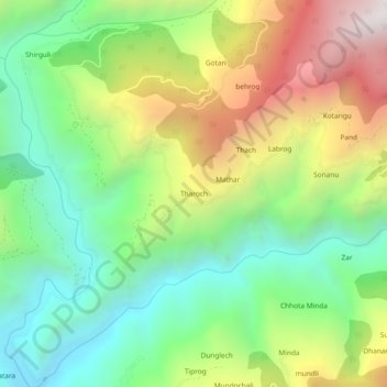
Name: Tharoch topographic map, elevation, terrain.
Location: Tharoch, Nerua, Shimla, Himachal Pradesh, India (30.95798 77.67089 30.99798 77.71089)
Average elevation: 6,037 ft
Minimum elevation: 4,183 ft
Maximum elevation: 8,980 ft
Thank you for supporting this site ❤️
Make a donation
Make a donation
Gear up for your next adventure:
As an Amazon Associate, this site earns from qualifying purchases at no extra cost to you.