Geolocate

Marion topographic map

Click on the map to display elevation.

About this map

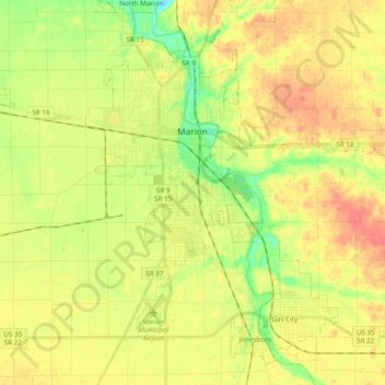
Name: Marion topographic map, elevation, terrain.

Location: Marion, Grant County, Indiana, United States (40.47905 -85.73158 40.59109 -85.53955)

Average elevation: 856 ft

Minimum elevation: 771 ft

Maximum elevation: 925 ft

Grant County trails, hiking, mountain biking, running and outdoor activities

Other topographic maps

Click on a map to view its topography, its elevation and its terrain.

Jalapa

United States > Indiana > Grant County

Average elevation: 810 ft

Gear up for your next adventure:

📻Weather Alert Radios - Stay informed of storm risks while off-the-grid
🧷Carabiner Set - Durable clips for gear attachment
🏕️Tent Footprint - Protect your tent base from wear
🌐World Map Poster - Decorative world maps with topographic info
🔊Portable Camp Speaker - Music and alerts at camp

As an Amazon Associate, this site earns from qualifying purchases at no extra cost to you.