Geolocate

Jalapa topographic map

Click on the map to display elevation.

About this map

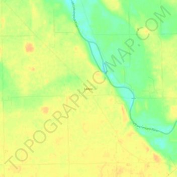
Name: Jalapa topographic map, elevation, terrain.

Location: Jalapa, Grant County, Indiana, United States (40.60775 -85.76536 40.64775 -85.72536)

Average elevation: 810 ft

Minimum elevation: 748 ft

Maximum elevation: 846 ft

Grant County trails, hiking, mountain biking, running and outdoor activities

Other topographic maps

Click on a map to view its topography, its elevation and its terrain.

Swayzee

United States > Indiana > Grant County

Average elevation: 863 ft

Marion

United States > Indiana > Grant County

Average elevation: 856 ft

Upland

United States > Indiana > Grant County

Average elevation: 912 ft

Marion

United States > Indiana > Grant County

Average elevation: 856 ft

Upland

United States > Indiana > Grant County

Average elevation: 912 ft

Gear up for your next adventure:

Backpacking Tents - Weight-optimized shelters for multi-day topographic surveys
📱Solar Portable Charger - Solar power bank for charging devices off‑grid
🔭Telescopic Hiking Pole - Adjustable pole for hiking stability
🎒Waterproof Dry Bags - Keep your electronics and maps dry inside your pack
📶Satellite Messenger - Communication device off‑grid

As an Amazon Associate, this site earns from qualifying purchases at no extra cost to you.