
Thank you for supporting this site ❤️
Make a donation
Make a donation
Gear up for your next adventure:
As an Amazon Associate, this site earns from qualifying purchases at no extra cost to you.
Blatten topographic map
Click on the map to display elevation.
Thank you for supporting this site ❤️
Make a donation
Make a donation
Gear up for your next adventure:
As an Amazon Associate, this site earns from qualifying purchases at no extra cost to you.
About this map
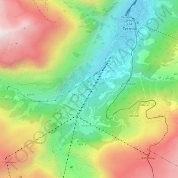
Name: Blatten topographic map, elevation, terrain.
Location: Blatten, Zermatt, Viège, Valais, 3920, Suisse (45.98762 7.71604 46.02762 7.75604)
Average elevation: 7,051 ft
Minimum elevation: 5,233 ft
Maximum elevation: 9,478 ft
Thank you for supporting this site ❤️
Make a donation
Make a donation
Gear up for your next adventure:
As an Amazon Associate, this site earns from qualifying purchases at no extra cost to you.