
Thank you for supporting this site ❤️
Make a donation
Make a donation
Gear up for your next adventure:
As an Amazon Associate, this site earns from qualifying purchases at no extra cost to you.
Vodochody topographic map
Click on the map to display elevation.
Thank you for supporting this site ❤️
Make a donation
Make a donation
Gear up for your next adventure:
As an Amazon Associate, this site earns from qualifying purchases at no extra cost to you.
About this map
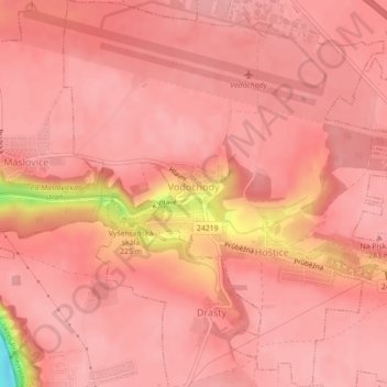
Name: Vodochody topographic map, elevation, terrain.
Location: Vodochody, okres Praha-východ, Central Bohemia, 25069, Czechia (50.19237 14.38302 50.22044 14.42148)
Average elevation: 899 ft
Minimum elevation: 564 ft
Maximum elevation: 945 ft
Thank you for supporting this site ❤️
Make a donation
Make a donation
Gear up for your next adventure:
As an Amazon Associate, this site earns from qualifying purchases at no extra cost to you.