
Thank you for supporting this site ❤️
Make a donation
Make a donation
Gear up for your next adventure:
As an Amazon Associate, this site earns from qualifying purchases at no extra cost to you.
Aláquez topographic map
Click on the map to display elevation.
Thank you for supporting this site ❤️
Make a donation
Make a donation
Gear up for your next adventure:
As an Amazon Associate, this site earns from qualifying purchases at no extra cost to you.
About this map
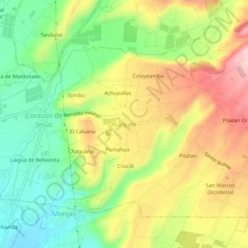
Name: Aláquez topographic map, elevation, terrain.
Location: Aláquez, Alaques, Latacunga, Cotopaxi, Ecuador (-0.88518 -78.61592 -0.84518 -78.57592)
Average elevation: 9,573 ft
Minimum elevation: 9,232 ft
Maximum elevation: 9,980 ft
Thank you for supporting this site ❤️
Make a donation
Make a donation
Gear up for your next adventure:
As an Amazon Associate, this site earns from qualifying purchases at no extra cost to you.