Geolocate

Aldersbach topographic map

Click on the map to display elevation.

About this map

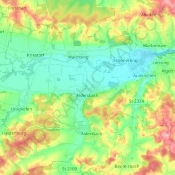
Name: Aldersbach topographic map, elevation, terrain.

Location: Aldersbach, Landkreis Passau, Bavaria, 94501, Germany (48.55303 12.98333 48.63141 13.12389)

Average elevation: 1,181 ft

Minimum elevation: 1,020 ft

Maximum elevation: 1,476 ft

Gear up for your next adventure:

📖Nature Tracking Books - Learn to track wildlife and terrain
🌄Hiking Binoculars - Compact binoculars for scenic views and trail spotting
🥤Water Filter Bottle - All‑in‑one filter bottle for safe hydration
👖Convertible Hiking Pants - Versatile zip-off pants for changing altitudes and temperatures
📷Action Camera - Capture your outdoor adventures in HD

As an Amazon Associate, this site earns from qualifying purchases at no extra cost to you.