Geolocate

Freeport topographic map

Click on the map to display elevation.

About this map

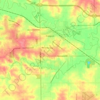
Name: Freeport topographic map, elevation, terrain.

Location: Freeport, Stephenson County, Illinois, 61032, United States (42.24932 -89.68657 42.32140 -89.57764)

Average elevation: 801 ft

Minimum elevation: 673 ft

Maximum elevation: 902 ft

Stephenson County trails, hiking, mountain biking, running and outdoor activities

Other topographic maps

Click on a map to view its topography, its elevation and its terrain.

Gear up for your next adventure:

😴Insulated Sleeping Pads - Compact and warm pads for high-elevation camping
🚑Emergency Bivvies - Heat-reflective sleeping bags for survival situations
🗺️Topographic Maps - Detailed topo maps for hiking, exploring and outdoor navigation
🪵Folding Camp Saw - Compact saw for wood and campsite work
📖Nature Tracking Books - Learn to track wildlife and terrain

As an Amazon Associate, this site earns from qualifying purchases at no extra cost to you.