
Thank you for supporting this site ❤️
Make a donation
Make a donation
Gear up for your next adventure:
As an Amazon Associate, this site earns from qualifying purchases at no extra cost to you.
Altagracia topographic map
Click on the map to display elevation.
Thank you for supporting this site ❤️
Make a donation
Make a donation
Gear up for your next adventure:
As an Amazon Associate, this site earns from qualifying purchases at no extra cost to you.
About this map
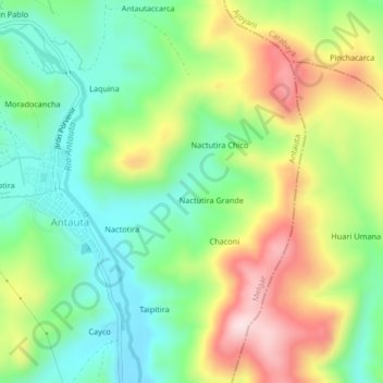
Name: Altagracia topographic map, elevation, terrain.
Location: Altagracia, Antauta, Province of Melgar, Puno, Peru (-14.31657 -70.29875 -14.27657 -70.25875)
Average elevation: 13,947 ft
Minimum elevation: 13,491 ft
Maximum elevation: 14,659 ft
Thank you for supporting this site ❤️
Make a donation
Make a donation
Gear up for your next adventure:
As an Amazon Associate, this site earns from qualifying purchases at no extra cost to you.