Geolocate

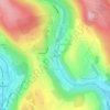
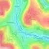
Llantrisant topographic map

Click on the map to display elevation.

Llantrisant

Llantrisant (Welsh pronunciation: [ɬanˈtrɪsant]; "Parish of the Three Saints") is a town and community in the county borough of Rhondda Cynon Taf, Wales. It lies within the historic county boundaries of Glamorgan, on the River Ely and the Afon Clun. The three saints of the town's name are Illtyd, Gwynno, and Dyfodwg. Llantrisant is a hilltop settlement, at an altitude of 174 m (571 ft) above sea level. The town is home to the Royal Mint.

Wikipedia (CC-BY-SA 3.0)

About this map

Name: Llantrisant topographic map, elevation, terrain.

Location: Llantrisant, Rhondda Cynon Taf, Wales, CF72 8BU, United Kingdom (51.50129 -3.41479 51.58129 -3.33479)

Average elevation: 341 ft

Minimum elevation: 52 ft

Maximum elevation: 846 ft

Other topographic maps

Click on a map to view its topography, its elevation and its terrain.

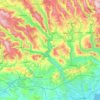
Llantwit Fardre

United Kingdom > Wales > Rhondda Cynon Taf > Tonteg

Average elevation: 404 ft

River Taff

United Kingdom > Wales > Rhondda Cynon Taf > Pontypridd

Average elevation: 643 ft

Pontypridd

United Kingdom > Wales > Rhondda Cynon Taf

Average elevation: 600 ft

Trealaw

United Kingdom > Wales > Rhondda Cynon Taf > Tonypandy

Average elevation: 728 ft

Mid Glamorgan

United Kingdom > Wales > Rhondda Cynon Taf

Average elevation: 771 ft

Pontypridd

United Kingdom > Wales > Rhondda Cynon Taf

Average elevation: 600 ft

Penrhiwceiber

United Kingdom > Wales > Rhondda Cynon Taf

Average elevation: 751 ft

Gear up for your next adventure:

🛠️Backpacking Tool Kit - Essential toolkit for outdoor repairs
🔋Solar Power Banks - Keep your GPS and phone charged in remote wilderness areas
🧤Tactile Hiking Gloves - Keep hands warm while operating GPS and smartphone screens
🧭Outdoor Navigation Book - Learn advanced navigation skills
🪑Portable Camp Table - Compact table for campsite meals

As an Amazon Associate, this site earns from qualifying purchases at no extra cost to you.