
Thank you for supporting this site ❤️
Make a donation
Make a donation
Gear up for your next adventure:
As an Amazon Associate, this site earns from qualifying purchases at no extra cost to you.
Schulen topographic map
Click on the map to display elevation.
Thank you for supporting this site ❤️
Make a donation
Make a donation
Gear up for your next adventure:
As an Amazon Associate, this site earns from qualifying purchases at no extra cost to you.
About this map
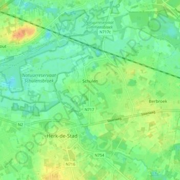
Name: Schulen topographic map, elevation, terrain.
Location: Schulen, Herk-de-Stad, Hasselt, Limburg, Belgium (50.93560 5.12931 50.97124 5.20940)
Average elevation: 82 ft
Minimum elevation: 43 ft
Maximum elevation: 144 ft
Thank you for supporting this site ❤️
Make a donation
Make a donation
Gear up for your next adventure:
As an Amazon Associate, this site earns from qualifying purchases at no extra cost to you.