
Thank you for supporting this site ❤️
Make a donation
Make a donation
Gear up for your next adventure:
As an Amazon Associate, this site earns from qualifying purchases at no extra cost to you.
Chuca topographic map
Click on the map to display elevation.
Thank you for supporting this site ❤️
Make a donation
Make a donation
Gear up for your next adventure:
As an Amazon Associate, this site earns from qualifying purchases at no extra cost to you.
About this map
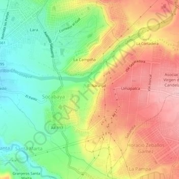
Name: Chuca topographic map, elevation, terrain.
Location: Chuca, Socabaya, Arequipa, 04012, Perú (-16.48593 -71.54039 -16.44593 -71.50039)
Average elevation: 7,694 ft
Minimum elevation: 7,405 ft
Maximum elevation: 7,995 ft
Thank you for supporting this site ❤️
Make a donation
Make a donation
Gear up for your next adventure:
As an Amazon Associate, this site earns from qualifying purchases at no extra cost to you.