
Thank you for supporting this site ❤️
Make a donation
Make a donation
Gear up for your next adventure:
As an Amazon Associate, this site earns from qualifying purchases at no extra cost to you.
Hisar topographic map
Click on the map to display elevation.
Thank you for supporting this site ❤️
Make a donation
Make a donation
Gear up for your next adventure:
As an Amazon Associate, this site earns from qualifying purchases at no extra cost to you.
About this map
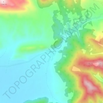
Name: Hisar topographic map, elevation, terrain.
Location: Hisar, Ağlasun, Burdur, Mediterranean Region, Turkey (37.56522 30.61538 37.60522 30.65538)
Average elevation: 3,727 ft
Minimum elevation: 3,363 ft
Maximum elevation: 4,606 ft
Thank you for supporting this site ❤️
Make a donation
Make a donation
Gear up for your next adventure:
As an Amazon Associate, this site earns from qualifying purchases at no extra cost to you.