Geolocate

Diffun topographic map

Click on the map to display elevation.

About this map

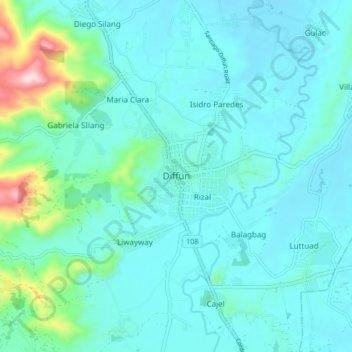
Name: Diffun topographic map, elevation, terrain.

Location: Diffun, Quirino, Cagayan Valley, Philippines (16.55353 121.46242 16.63353 121.54242)

Average elevation: 512 ft

Minimum elevation: 308 ft

Maximum elevation: 1,716 ft

Other topographic maps

Click on a map to view its topography, its elevation and its terrain.

Maddela

Philippines > Quirino

Average elevation: 1,463 ft

Cagayan River

Philippines > Quirino

Average elevation: 1,453 ft

Addalam River

Philippines > Quirino

Average elevation: 1,496 ft

Saguday

Philippines > Quirino

Average elevation: 367 ft

Aglipay

Philippines > Quirino

Average elevation: 607 ft

Cabarroguis

Philippines > Quirino

Average elevation: 971 ft

Nagtipunan

Philippines > Quirino

Average elevation: 1,795 ft

Diffun

Philippines > Quirino

Average elevation: 827 ft

Maddela

Philippines > Quirino

Average elevation: 1,463 ft

Gear up for your next adventure:

🥩Freeze-Dried Meals - Nutritious and lightweight food for remote expeditions
🧷Carabiner Set - Durable clips for gear attachment
🧴Hand Sanitizer - Keep hands clean while hiking
🚗GPS Dash Cams - Record your scenic drives through mountain passes and canyons
🌲Outdoor Survival Books - Best books on survival skills

As an Amazon Associate, this site earns from qualifying purchases at no extra cost to you.