Thank you for supporting this site ❤️
Make a donation
Make a donation
Gear up for your next adventure:
As an Amazon Associate, this site earns from qualifying purchases at no extra cost to you.
Hibbing topographic map
Click on the map to display elevation.
Thank you for supporting this site ❤️
Make a donation
Make a donation
Gear up for your next adventure:
As an Amazon Associate, this site earns from qualifying purchases at no extra cost to you.
About this map
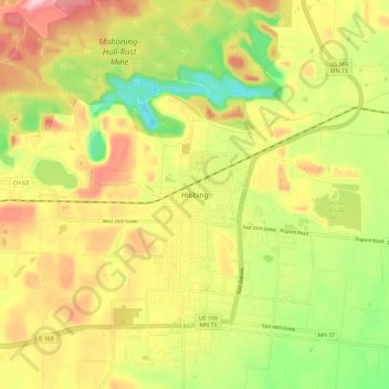
Name: Hibbing topographic map, elevation, terrain.
Location: Hibbing, Saint Louis County, Minnesota, 55746, United States (47.38716 -92.97769 47.46716 -92.89769)
Average elevation: 1,490 ft
Minimum elevation: 1,171 ft
Maximum elevation: 1,808 ft
Saint Louis County trails, hiking, mountain biking, running and outdoor activities
Thank you for supporting this site ❤️
Make a donation
Make a donation
Gear up for your next adventure:
As an Amazon Associate, this site earns from qualifying purchases at no extra cost to you.
