Geolocate

Bagumbong topographic map

Click on the map to display elevation.

About this map

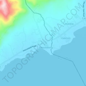
Name: Bagumbong topographic map, elevation, terrain.

Location: Bagumbong, Rizal, Calabarzon, Philippines (14.32291 121.35563 14.36291 121.39563)

Average elevation: 112 ft

Minimum elevation: -3 ft

Maximum elevation: 1,253 ft

Gear up for your next adventure:

🖼️Topo Map Wall Art - Decorative topographic prints of famous peaks and regions
🏥Hiking First Aid Kits - Comprehensive medical kits for remote trail injuries
🦶Carbon Trekking Poles - Reduce knee impact on steep descents with ultra-light poles
🧭Orienteering Set - Complete compass and map reading kit
📷Action Camera - Capture your outdoor adventures in HD

As an Amazon Associate, this site earns from qualifying purchases at no extra cost to you.